Wanderlust-Wiki

Understand the signs. Find your way.

Signs in forests and on the trail: a selection of common symbols and regional route markings.

There is no single worldwide forest-sign system. Our original SVG drawings are simplified learning illustrations, not official or certified templates. Additional wording, local rules and current closures take precedence.

Rules & restrictions

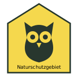
Owl: nature reserve

Germany · Thuringia example

Owl: nature reserve

In Thuringia an owl on a yellow sign identifies a nature reserve. Other German states also use different symbols. Read the reserve rules and supplementary panels: the symbol alone does not explain every restriction.

Thüringer Schulportal · Verhalten im Naturschutzgebiet ↗
No open flames

Many protected areas; Harz example

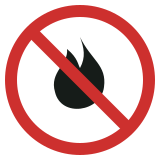
No open flames

A crossed-out flame prohibits open fire. Harz National Park also prohibits camping stoves. Read additional wording and local rules.

Nationalpark Harz · Verhalten ↗
No camping

Protected areas; local rules

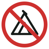
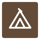
No camping

A crossed-out tent indicates no camping. Local rules determine whether this also includes bivouacking.

Nationalpark Harz · Verhalten ↗
No bicycles

Local path restrictions

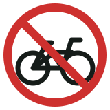
No bicycles

A crossed-out bicycle excludes bicycles. Read the wording: dismounting and pushing is not automatically permitted everywhere.

Nationalpark Harz · Verhalten ↗
Keep dogs on a lead

Local rule; Harz example

Keep dogs on a lead

A dog on a lead asks you to keep your dog leashed. This applies year-round in Harz. Designs and exceptions vary elsewhere.

Nationalpark Harz · Verhalten ↗

Warnings

Forestry operations

Working forests; England example

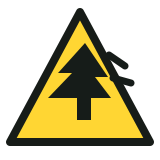
Forestry operations

Warnings and closures may indicate tree felling or machinery. Follow diversions and stay outside work areas. Our drawing is a simplified example.

Forestry England · Safety in the forest ↗

Information & help

Forest rescue meeting point

Germany · Thuringia example

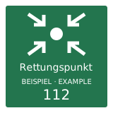
Forest rescue meeting point

Rescue meeting points have a unique identifier. In an emergency give the actual sign identifier and incident location to the emergency operator and follow their instructions. Help is not permanently stationed here. Our illustration deliberately has no real location code.

Thüringer Gesetz- und Verordnungsblatt · Rettungspunkte ↗
Natura 2000: protected habitats

European Union · protected-area network

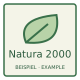
Natura 2000: protected habitats

Natura 2000 is the European protected-area network. A notice does not mean a blanket entry ban: local conservation rules apply. Our panel is an original illustration, not a reproduction of the official Natura 2000 logo.

Europäische Kommission · Natura 2000 ↗
First aid

Widely used safety signage

First aid

A white cross on green identifies first-aid facilities or equipment. It does not guarantee a staffed station. Follow any directional information.

HSE · Safety signs and signals ↗

Regional trail markers

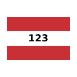
Red–white–red with route number

Austria · Carinthia example

Red–white–red with route number

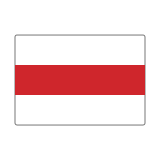
In Carinthia red–white–red bars mark mountain routes, often with a black route number in the white band. They do not indicate difficulty. Do not equate them with Swiss white–red–white markings; systems also differ within Austria.

Österreichischer Alpenverein · Bergwege in Kärnten ↗
Blue dot: easy mountain trail

German & Austrian Alps · regional

Blue dot: easy mountain trail

In this Alpine Club system blue indicates easy mountain trails. They can still be narrow or steep. Sure-footedness and suitable equipment remain necessary. This is not a Europe-wide classification.

Deutscher Alpenverein · Schwierigkeitsgrade ↗
Red dot: moderately difficult trail

German & Austrian Alps · regional

Red dot: moderately difficult trail

Red here indicates moderately difficult mountain trails, which may include exposed and secured sections. Sure-footedness and a head for heights matter. Read local information and the route description.

Deutscher Alpenverein · Schwierigkeitsgrade ↗
Black dot: difficult mountain trail

German & Austrian Alps · regional

Black dot: difficult mountain trail

Black here indicates difficult mountain trails with demanding, sometimes exposed sections and possible scrambling. Alpine experience, secure movement and a realistic assessment of your abilities are required.

Deutscher Alpenverein · Schwierigkeitsgrade ↗
E1: European long-distance path

Europe · international long-distance paths

E1: European long-distance path

A blue sign with yellow stars and an E-number can identify a European long-distance path. These routes use national and regional trail networks; additional E-markers are not present everywhere. E1 does not indicate section difficulty.

European Hiking Federation · E-paths ↗
White–blue–white

Switzerland

White–blue–white

Swiss marking for demanding alpine hiking trails. These are not ordinary forest walks; additional alpine skills and equipment may be needed.

Schweizer Wanderwege · Wegkategorien ↗

Research: 21 October 2026 · Original SVG drawings by Mario & Aik.

Mario at his desk

By Mario & Aik

Curiosity connects.

A personal learning project.
Explore, understand, think further.

Meet Mario & Aik ↗
Aik, illustrated AI assistant with code symbols